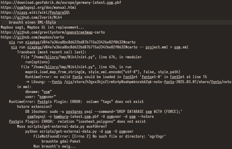
Screenshot of my notes trying to get things to work.
https://assets.chaos.social/media_attachments/files/114/309/044/686/016/936/original/ec5b038cf3dce945.png
Next, I tried to do some rendering myself! This would give me a lot of control of the result – I could make subway lines more visible, for example!
Unfortunately, this seems to requires the following tower of technologies:
1. Download the raw OSM data.
2. Import it into a Postgres database using osm2pgsql.
3. Compile the "Carto" style using CartoCSS preprocessor (which seems unmaintained 😱).
4. Run the mapnik renderer.
I had trouble fitting all of these pieces together properly, and gave up.
GNU social JP is a social network, courtesy of GNU social JP管理人. It runs on GNU social, version 2.0.2-dev, available under the GNU Affero General Public License.
![]() All GNU social JP content and data are available under the Creative Commons Attribution 3.0 license.
All GNU social JP content and data are available under the Creative Commons Attribution 3.0 license.