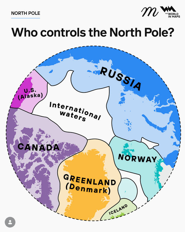
An infographic titled “Who controls the North Pole?” showing a circular polar map of the Arctic region with surrounding countries and maritime zones. The North Pole itself sits in a central white area labeled “International waters,” indicating it is not owned by any single nation. Around this central zone are colored segments representing the Arctic coastal states. Russia occupies the largest area on the right in blue, Canada is shown on the left in purple, and the United States appears as a smaller segment labeled “U.S. (Alaska)” in pink. Greenland, labeled as part of Denmark, appears in orange near the bottom center, while Norway is shown in teal to the lower right. Iceland appears as a small green segment at the bottom edge. The map emphasizes how the Arctic Ocean is surrounded by these nations but that the central polar region remains outside national jurisdiction, governed instead by international law. A dashed circular boundary encloses the map, and the design uses bold labels and contrasting colors to clearly distinguish each country’s area.
https://cdn.masto.host/vissocial/media_attachments/files/116/652/776/066/334/878/original/bce024df2ba836e7.png
 Information Is Beautiful
 All GNU social JP content and data are available under the