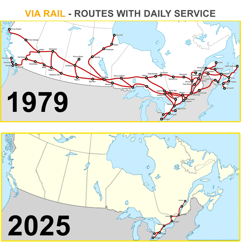
A split-panel image titled "VIA RAIL - ROUTES WITH DAILY SERVICE". The top panel, labeled "1979," shows a map of Canada with a comprehensive, interconnected network of red lines representing numerous rail routes with daily service across the country. Key cities like Vancouver, Edmonton, Calgary, Winnipeg, Toronto, Montreal, and Halifax are all connected. The bottom panel, labeled "2025," shows the same map of Canada with a significantly reduced network of rail lines. The red lines are confined to a single, central route connecting Toronto and Montreal, and a handful of other short segments. The stark contrast between the two maps highlights the dramatic reduction in daily passenger rail service in Canada over the decades.
https://cdn.masto.host/vissocial/media_attachments/files/116/648/057/389/166/838/original/71a5bb41bc501a49.png
 Information Is Beautiful
 All GNU social JP content and data are available under the