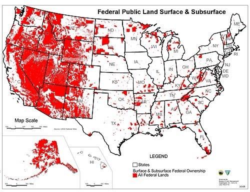
A map of the US showing all the federal public land. Most of the map west of the Rocky Mountains, including most land in some the best states for solar power, is federal public land.
https://cdn.masto.host/zirkus/media_attachments/files/114/962/015/277/272/612/original/81b32168694bd21b.jpeg