GNU social JP
  • FAQ
  • Login
GNU social JPは日本のGNU socialサーバーです。
Usage/ToS/admin/test/Pleroma FE
  • Public

    • Public
    • Network
    • Groups
    • Featured
    • Popular
    • People

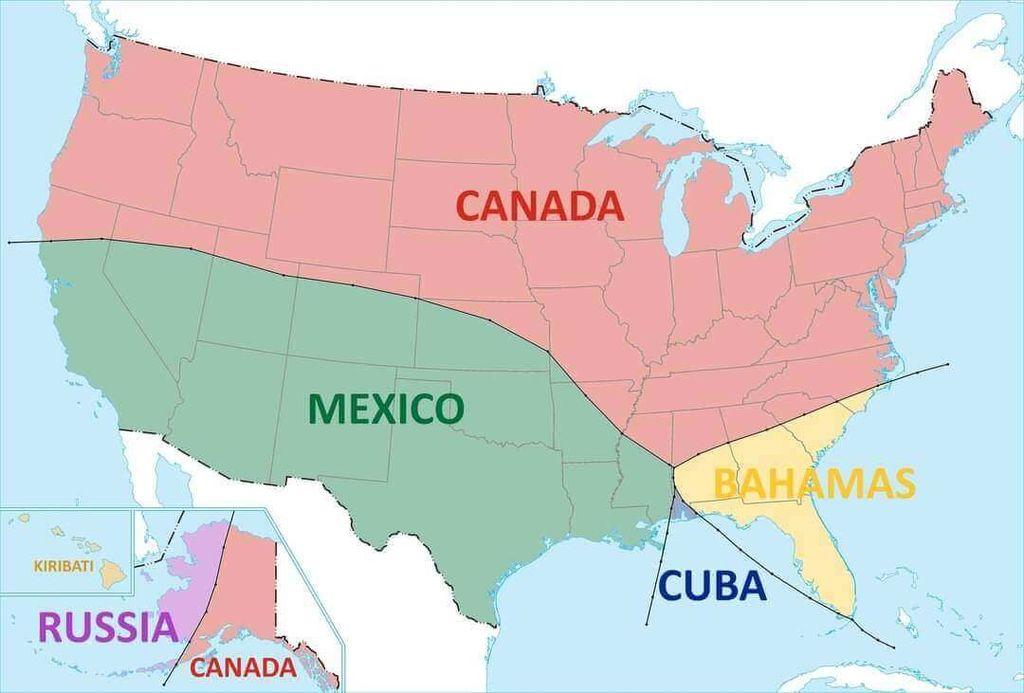
A map of the contiguous United States with transparent overlays of the outlines of Canada, Mexico, Cuba, and the Bahamas. Canada's outline is shown in pink and covers the northernmost states. Mexico's outline is in green and covers the southwestern states. Cuba's outline is in blue and is positioned over Florida. The Bahamas' outline is in yellow and is located to the east of Florida. An inset map shows a small portion of Russia and Canada overlaid on the Aleutian Islands.

Download link

https://cdn.masto.host/vissocial/media_attachments/files/114/643/128/244/360/955/original/e591c39f90743f25.jpeg

Notices where this attachment appears

  1. Embed this notice
    Information Is Beautiful (infobeautiful@vis.social)'s status on Sunday, 08-Jun-2025 02:28:44 JST Information Is Beautiful Information Is Beautiful

    The nearest other country...

    (by @amazingmap)

    In conversation about 7 months ago from vis.social permalink
  • Help
  • About
  • FAQ
  • TOS
  • Privacy
  • Source
  • Version
  • Contact

GNU social JP is a social network, courtesy of GNU social JP管理人. It runs on GNU social, version 2.0.2-dev, available under the GNU Affero General Public License.

Creative Commons Attribution 3.0 All GNU social JP content and data are available under the Creative Commons Attribution 3.0 license.