GNU social JP
  • FAQ
  • Login
GNU social JPは日本のGNU socialサーバーです。
Usage/ToS/admin/test/Pleroma FE
  • Public

    • Public
    • Network
    • Groups
    • Featured
    • Popular
    • People

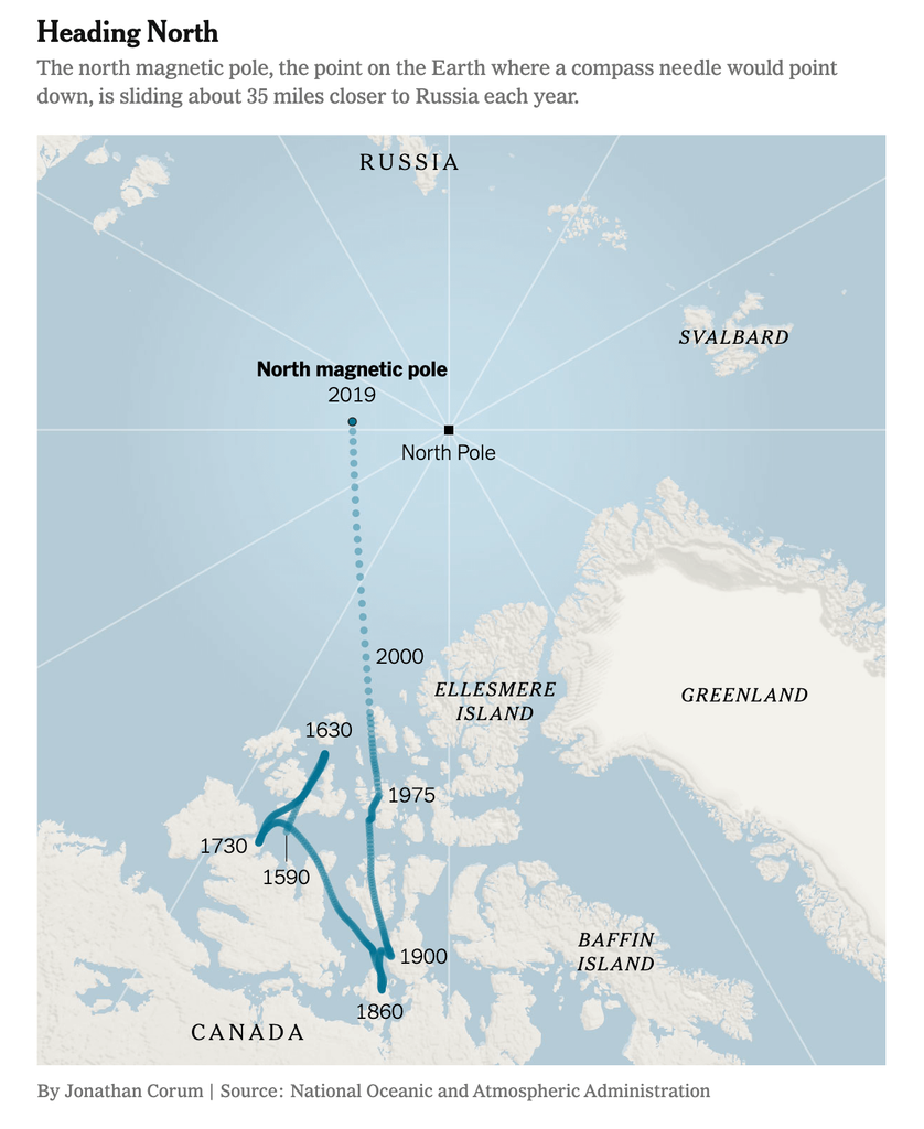
A map titled 'Heading North' showing the movement of Earth's north magnetic pole from 1590 to 2019. The map displays the Arctic region, including parts of Canada, Greenland, Russia, and Svalbard. A blue line traces the magnetic pole's path from southern Canada in 1590, meandering northward through the Canadian Arctic Archipelago until 1900, then continuing as a dotted line toward Russia through 2019. The geographic North Pole is marked with a black square. The map illustrates that the magnetic pole is moving about 35 miles closer to Russia each year.

Download link

https://cdn.masto.host/vissocial/media_attachments/files/114/461/463/052/482/647/original/6aeffa3b61eb4bec.png

Notices where this attachment appears

  1. Embed this notice
    Information Is Beautiful (infobeautiful@vis.social)'s status on Thursday, 08-May-2025 09:36:33 JST Information Is Beautiful Information Is Beautiful

    The movement of the magnetic North Pole over 400 years
    https://www.nytimes.com/2019/02/04/science/north-magnetic-pole-model.html

    In conversation about a month ago from vis.social permalink
  • Help
  • About
  • FAQ
  • TOS
  • Privacy
  • Source
  • Version
  • Contact

GNU social JP is a social network, courtesy of GNU social JP管理人. It runs on GNU social, version 2.0.2-dev, available under the GNU Affero General Public License.

Creative Commons Attribution 3.0 All GNU social JP content and data are available under the Creative Commons Attribution 3.0 license.