GNU social JP
  • FAQ
  • Login
GNU social JPは日本のGNU socialサーバーです。
Usage/ToS/admin/test/Pleroma FE
  • Public

    • Public
    • Network
    • Groups
    • Featured
    • Popular
    • People

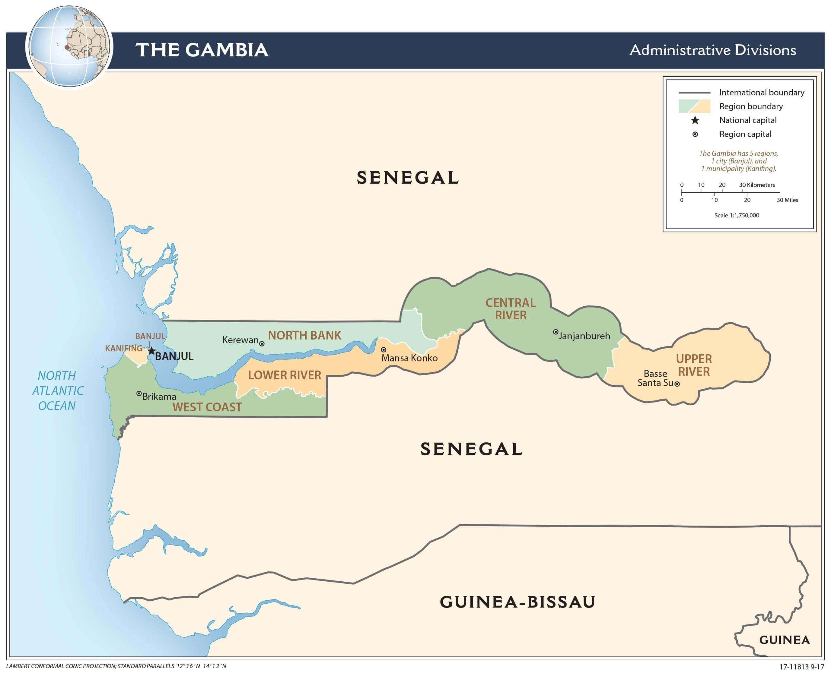
A map showing the administrative divisions of The Gambia. The country is depicted as a narrow strip of land extending inland from the Atlantic coast, surrounded by Senegal on the north, east, and south. The map labels the different regions: West Coast, Lower River, North Bank, Central River, and Upper River. It also indicates international and region boundaries, the national capital Banjul, and regional capitals. A scale bar and legend are provided for reference.

Download link

https://cdn.masto.host/vissocial/media_attachments/files/114/427/489/106/997/924/original/afcfd12feee9dd75.jpeg

Notices where this attachment appears

  1. Embed this notice
    Information Is Beautiful (infobeautiful@vis.social)'s status on Thursday, 01-May-2025 09:36:44 JST Information Is Beautiful Information Is Beautiful

    Is Gambia the strangest-shaped country?

    In conversation about 2 months ago from vis.social permalink
  • Help
  • About
  • FAQ
  • TOS
  • Privacy
  • Source
  • Version
  • Contact

GNU social JP is a social network, courtesy of GNU social JP管理人. It runs on GNU social, version 2.0.2-dev, available under the GNU Affero General Public License.

Creative Commons Attribution 3.0 All GNU social JP content and data are available under the Creative Commons Attribution 3.0 license.