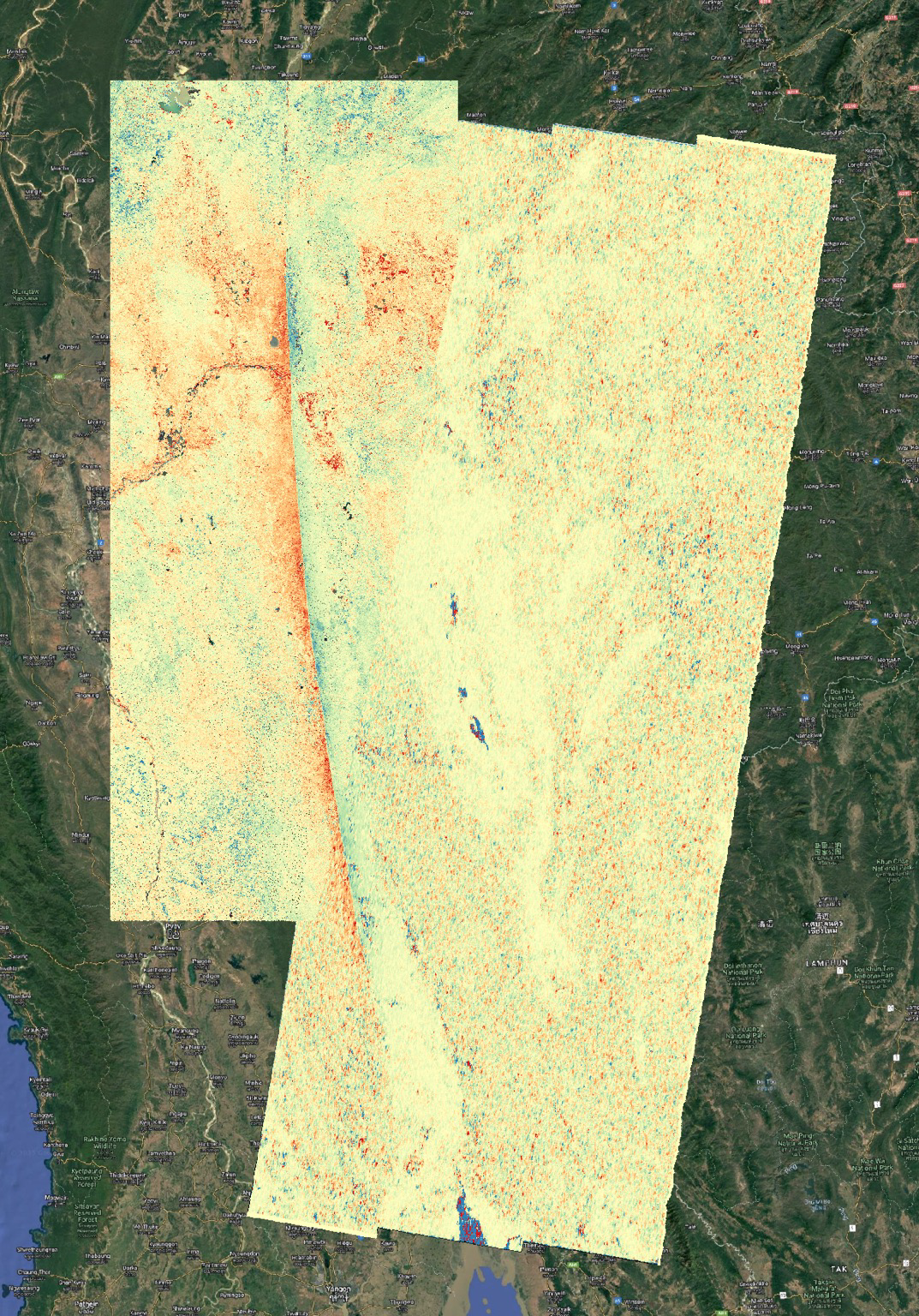
Map of Myanmar area showing sharp color change along the fault running roughly north-south. Red on west side where land moved northward.
https://files.mastodon.social/media_attachments/files/114/264/111/785/411/252/original/9a04195d435bdeb9.png
NASA JPL ARIA project analysis of data from Copernicus Sentinel-2 optical and Sentinel-1 radar images measured the slip on the Sagaing Fault in Myanmar. Quick preliminary map. More details later. Fault ruptured about 500 km (300 miles) in the magnitude 7.7 earthquake on 28 March 2025. Red is northward movement and blue is southward movement. This is pixel offset tracking or optical image correlation measurements of horizontal displacements.
GNU social JP is a social network, courtesy of GNU social JP管理人. It runs on GNU social, version 2.0.2-dev, available under the GNU Affero General Public License.
![]() All GNU social JP content and data are available under the Creative Commons Attribution 3.0 license.
All GNU social JP content and data are available under the Creative Commons Attribution 3.0 license.