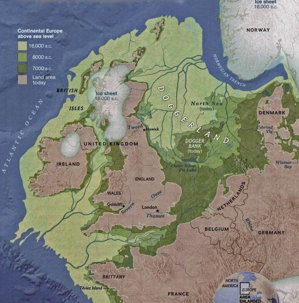
A map illustrating the changing landscape of the North Sea region over time, specifically focusing on Doggerland, a now-submerged landmass that connected Great Britain to mainland Europe. The map shows the ice sheet coverage at different points in time (16,000 BC, 8000 BC, 7000 BC), revealing how the landmass gradually became submerged as sea levels rose.
https://cdn.masto.host/vissocial/media_attachments/files/114/109/926/747/590/277/original/af505f47bf73152e.jpeg