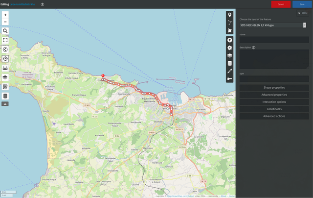
🕶️ A view of its IU (on a dark theme) with a partial map of Normandy (France) on the main section, with a signposted itinerary and buttons on either side of the map to set the parameters for what the user wants to appear on it, and more general parameters on the right. 📚️ uMap is a libre, multi-platform tool to customize maps with OpenStreetMap layers in a minute and integrate them into a site. The user selects the type of map desired and enters points of interest (markers, lines, polygons, links, images, ...), chooses the license of his data, save his map online (prior registration required), then shares his dynamic online map on the site of his choice. The editor allows many customizations (colors, icons, minimap, ...). Excellent and libre!
https://cdn.masto.host/floss/media_attachments/files/114/106/148/684/741/494/original/39ade8eba2cf5a4f.png