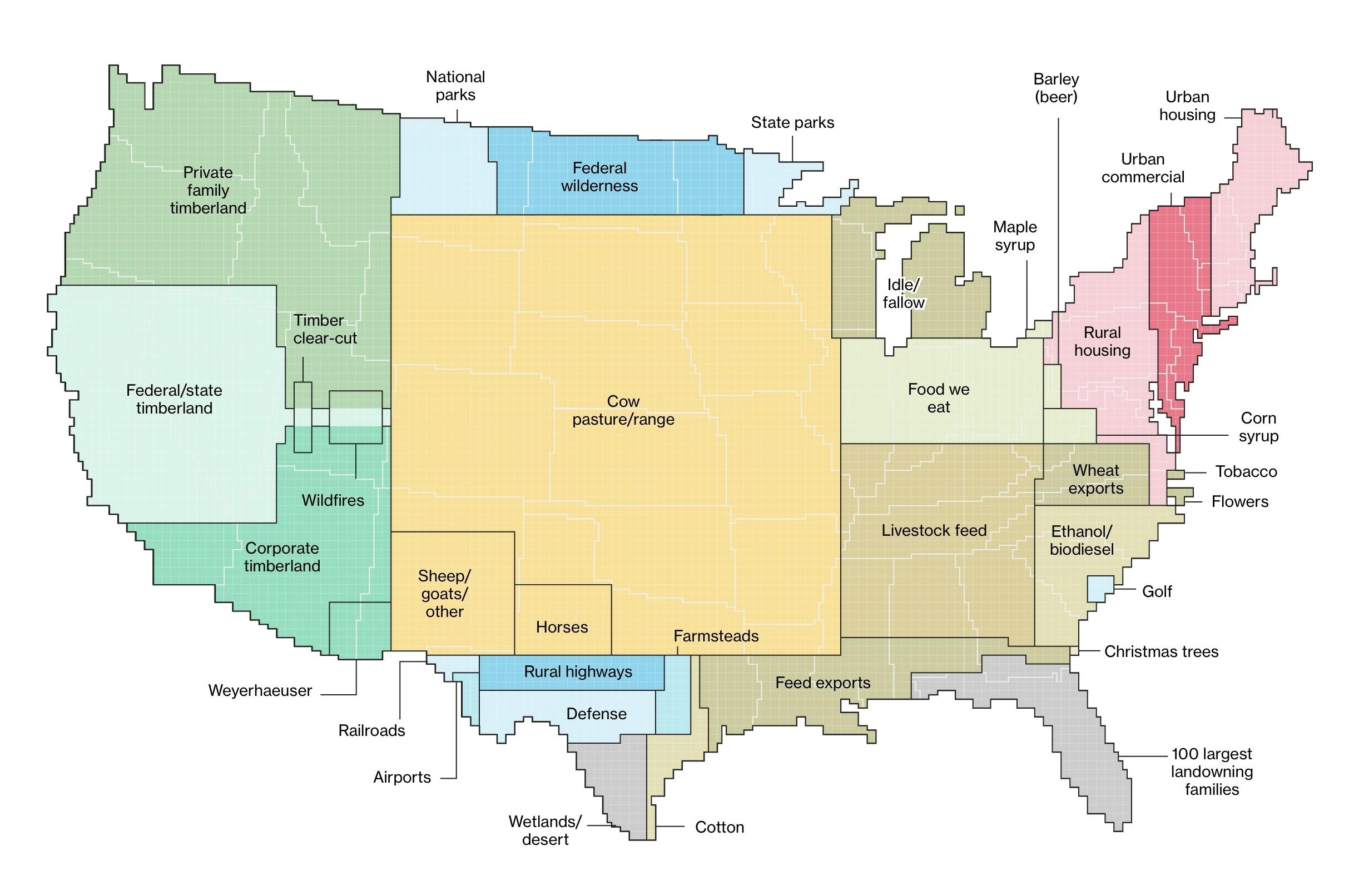
This is a cartogram map of the United States depicting land use by different categories. The map distorts state shapes to represent proportional land usage. Key land use types include cow pasture/range (covering much of the central U.S.), private and federal timberland in the Pacific Northwest, corporate timberland in the Southeast, and urban housing/commercial areas in the Northeast. Other categories include agriculture (livestock feed, wheat exports, ethanol/biodiesel, cotton), protected lands (national parks, federal wilderness, state parks), and infrastructure (railroads, airports, highways). Additional specialized land uses include wildfires, golf courses, Christmas tree farms, and maple syrup production.
https://s3.eu-central-2.wasabisys.com/mastodonworld/media_attachments/files/114/077/042/213/388/835/original/0f38e1c4b61ce714.jpg