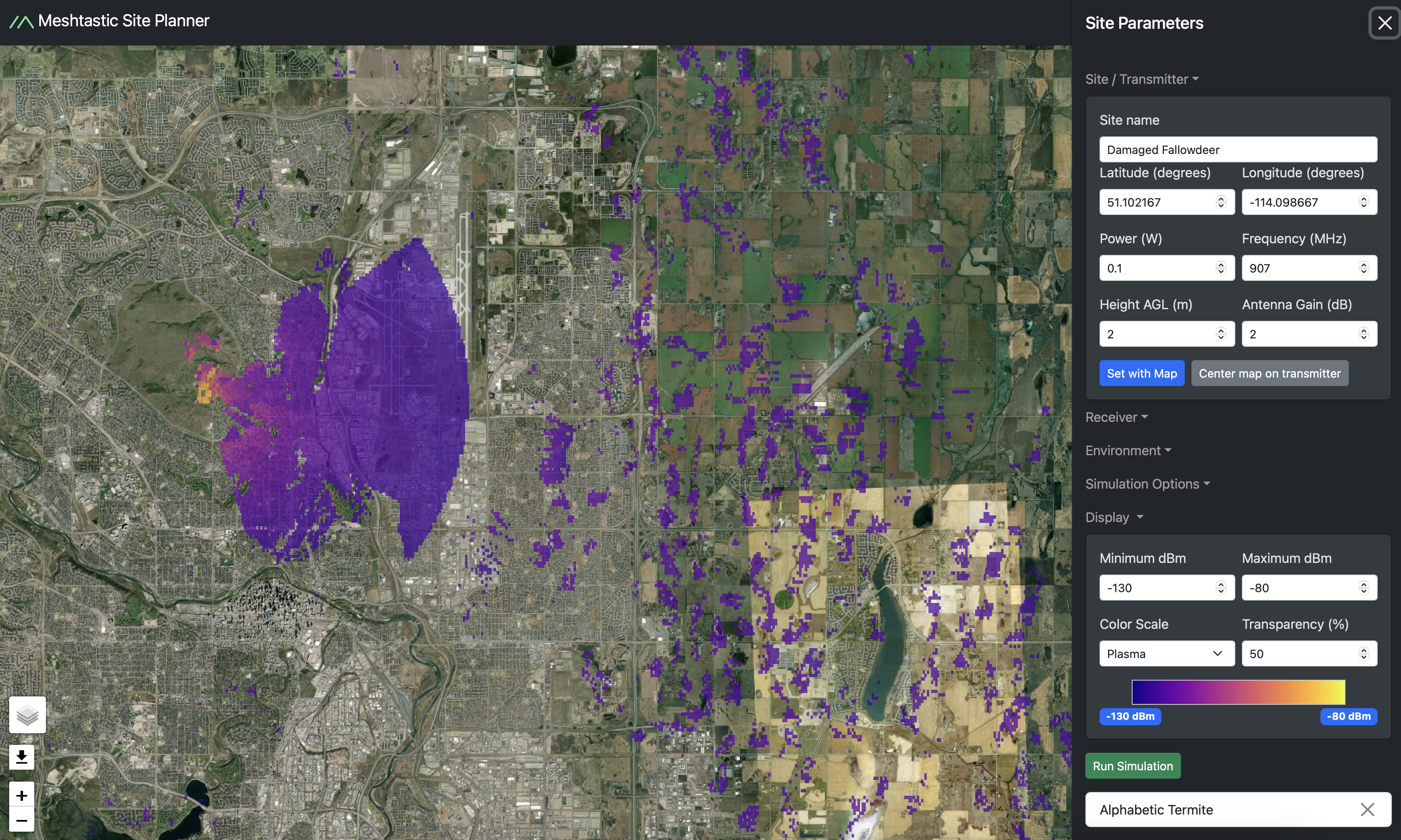
Screenshot of the Meshtastic Site Planner interface displaying a satellite map with color-coded signal coverage. The map shows a large purple-shaded area indicating predicted radio signal reach, with orange and yellow regions representing stronger signals. The right-side panel lists site parameters such as latitude, longitude, power, frequency, and antenna gain. A color scale bar at the bottom indicates signal strength ranging from -130 dBm to -80 dBm. Various simulation and display options are visible, including transparency settings and a ‘Run Simulation’ button.
https://files.mastodon.social/media_attachments/files/113/845/205/534/690/352/original/f4dc49d2dac1ee37.png