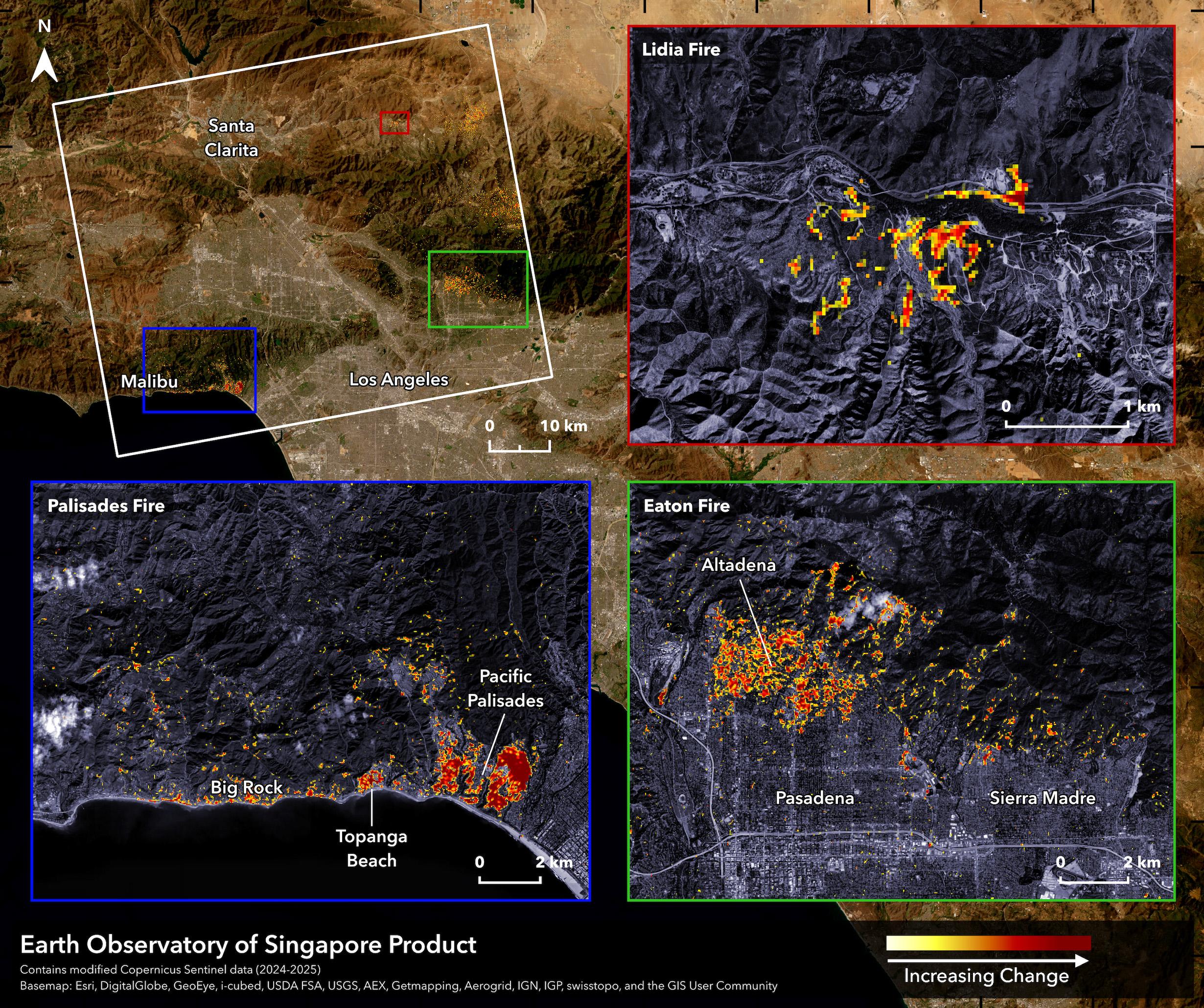
EOS-RS Damage Proxy Map: California, USA, Wildfires, 9 Jan 2025, v0.9 The Earth Observatory of Singapore - Remote Sensing Lab (EOS-RS) created this preliminary Damage Proxy Map (DPM) depicting areas that are likely damaged in California, USA, due to several wildfires in early Jan 2025. This map was derived from synthetic aperture radar (SAR) images acquired by the Copernicus Sentinel-1 satellite operated by the European Space Agency (ESA) before (11 Sep 2024 to 28 Dec 2024) and during (9 Jan 2025) the event. The map covers area indicated by a white polygon. Damage is shown by colored pixels of 30m in size, where yellow to red indicates increasingly significant ground surface change before and after the event. Preliminary validation was conducted using news reports and ground-level imagery and videos in selected areas. This map should be used as a guidance to identify damaged areas, and may be less reliable over vegetated or mountainous areas. Scattered pixels may be false positives, and a lack of color may not mean no damage. The product contains modified Copernicus Sentinel data (2024-2025), processed by ESA and analyzed by the Earth Observatory of Singapore - Remote Sensing Lab (EOS-RS). More map details and files at: https://eos-rs-products.earthobservatory.sg/EOS-RS_202501_USA_California_Wildfires/ Credits: Earth Observatory of Singapore - Remote Sensing Lab (EOS-RS), Contains modified Copernicus Sentinel data (2024-2025)
https://files.mastodon.social/media_attachments/files/113/810/920/896/012/438/original/a9c21eec168c7a40.jpg