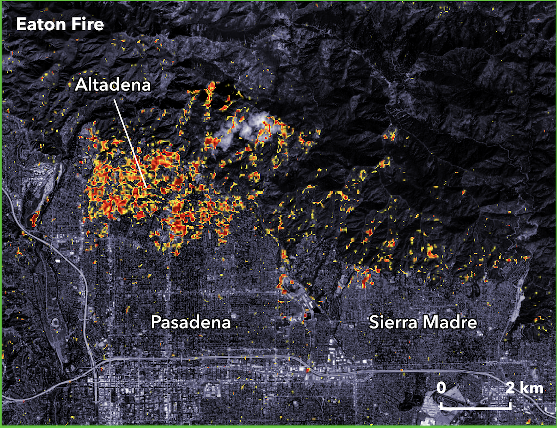
Map of Altadena, Pasadena and adjacent area showing a proxy for damage derived from Copernicus Sentinel-1 radar image acquired at 6 PM local Pacific Time on January 8. Colors show the extensive damage across most of Altadena and the north edge of Pasadena, extending int the north edge of Sierra Madre.
https://files.mastodon.social/media_attachments/files/113/810/876/325/508/020/original/1c00f8d4da30e02c.png