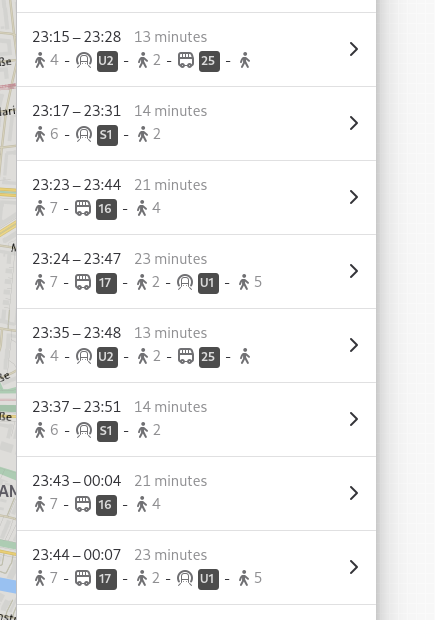
Public transit itineraries in GNOME Maps with added indicators for walking leg durations
https://cdn.fosstodon.org/media_attachments/files/113/727/130/814/213/197/original/7c51877a599aaa45.png
Experimenting with showing walking leg durations (in minutes) for public transit itiniraries in the overview list in Maps…
Does this makes sense, or would be confusing (maybe mixing it up with the line number/name badges shown for transit legs?).
GNU social JP is a social network, courtesy of GNU social JP管理人. It runs on GNU social, version 2.0.2-dev, available under the GNU Affero General Public License.
![]() All GNU social JP content and data are available under the Creative Commons Attribution 3.0 license.
All GNU social JP content and data are available under the Creative Commons Attribution 3.0 license.