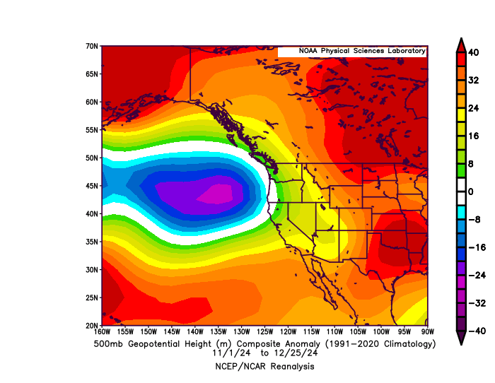
Map of 500mg geopotential height anomalies from Oct 1 through late Dec from the NCEP R1 reanalysis plotter (NOAA PSL). It depicts a region of persistent subtropical ridging that has kept SoCal extremely dry and warm, but also a conspicuous low pressure area west of the PacNW that has directed a prolonged sequence of warm/wet storms onto the West Coast from about San Francisco northward.
https://files.mastodon.social/media_attachments/files/113/725/772/662/752/158/original/a6a21851c0184c13.gif