Untitled attachment
https://media2.ai6yr.org/media_attachments/files/113/612/504/908/169/165/original/fcf1573d6c6aa872.jpg
Got bad data?
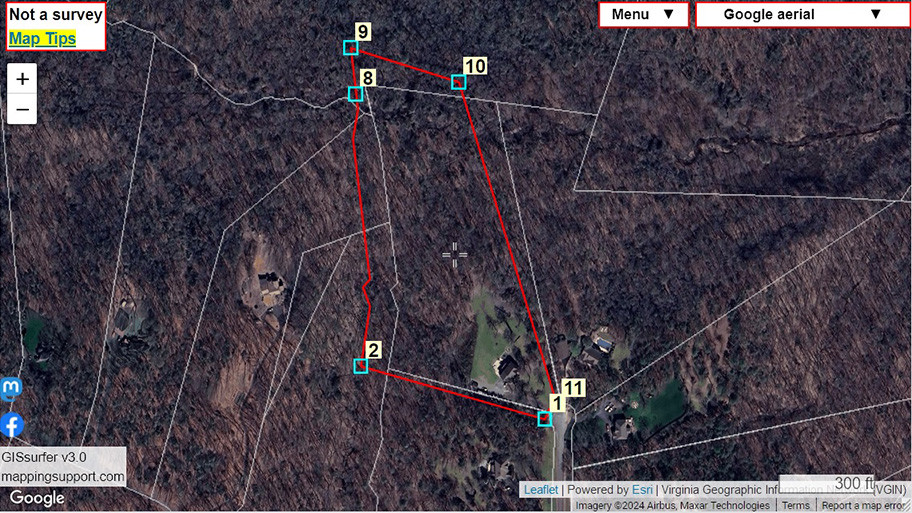
Here is another example of why you should be cautious about relying on apps like onX, LandGlide, Regrid, etc that show property line data.
A client sent me the survey map for their subdivision and ask me to produce a map showing the approximate location of their property lines and survey stakes. Software that I developed used the survey data to produce the red lines and survey stake locations you see on the screenshot.
The white lines are the county #GIS parcel line data which obviously has significant problems. The apps that show property lines simply display a copy of the county GIS parcel line data.
#Geospatial
GNU social JP is a social network, courtesy of GNU social JP管理人. It runs on GNU social, version 2.0.2-dev, available under the GNU Affero General Public License.
![]() All GNU social JP content and data are available under the Creative Commons Attribution 3.0 license.
All GNU social JP content and data are available under the Creative Commons Attribution 3.0 license.