GNU social JP
  • FAQ
  • Login
GNU social JPは日本のGNU socialサーバーです。
Usage/ToS/admin/test/Pleroma FE
  • Public

    • Public
    • Network
    • Groups
    • Featured
    • Popular
    • People

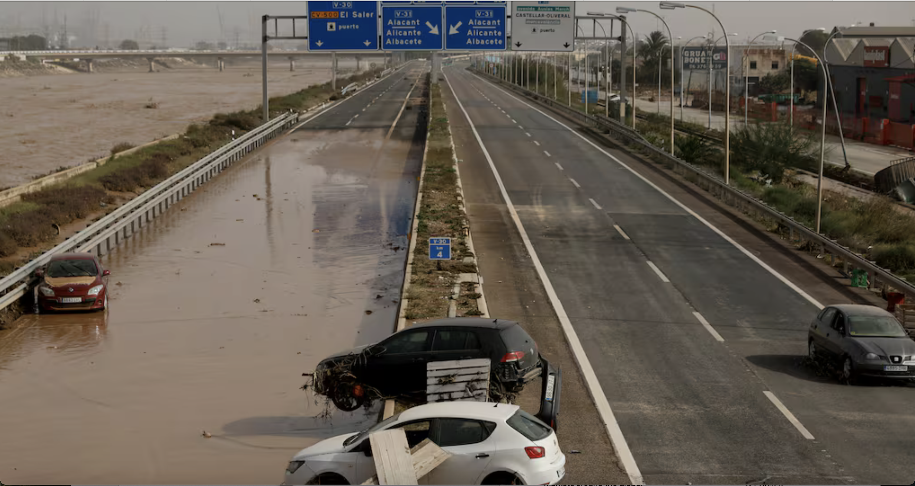
After the extreme rain events this is a picture from the El País newspaper showing a stretch of the V-30 that runs alongside the Turia river. The river is in full flood, very wide with brown turbulent water on the left. In the centre of the picture, the road is partially flooded and there are cars abandoned and debris overtop the road. A roadway sign stretches over the 4 lanes of traffic.

Download link

https://mstdn.chrisalemany.ca/system/media_attachments/files/113/396/975/222/030/656/original/c777f3cda7bdd63c.png

Notices where this attachment appears

  1. Embed this notice
    Chris Alemany🇺🇦🇨🇦🇪🇸 (chris@mstdn.chrisalemany.ca)'s status on Friday, 01-Nov-2024 04:46:31 JST Chris Alemany🇺🇦🇨🇦🇪🇸 Chris Alemany🇺🇦🇨🇦🇪🇸
    in reply to

    Just went and geolocated this picture for an after climate-disaster/before climate-disaster look on Google Maps. Map link below, the main highway V-30, that runs around the south side of the City of Valencia alonside the, often dry, riverbed of the Turia river. #ClimateAction #ClimateEmergency #ClimateChange #valencia #españa #valencia #cambioclimatico #climático

    https://maps.app.goo.gl/iuWwS55MMrmyyiK96
    @Jade
    @danneau

    In conversation about 7 months ago from mstdn.chrisalemany.ca permalink
  • Help
  • About
  • FAQ
  • TOS
  • Privacy
  • Source
  • Version
  • Contact

GNU social JP is a social network, courtesy of GNU social JP管理人. It runs on GNU social, version 2.0.2-dev, available under the GNU Affero General Public License.

Creative Commons Attribution 3.0 All GNU social JP content and data are available under the Creative Commons Attribution 3.0 license.