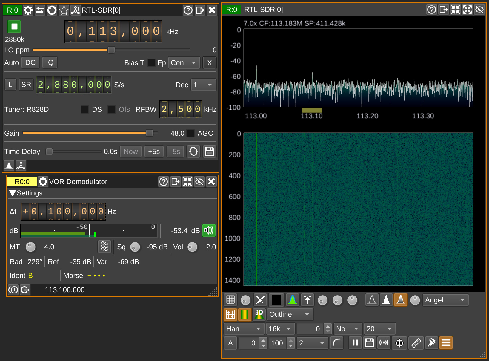
View of SDRangel, it decodes the signal in the lower left, and shows 229°!
https://assets.chaos.social/media_attachments/files/112/072/444/750/781/074/original/5029b31e8a681a21.png
46: Receive navigational aids for airplanes
There are ground stations that emit a signal that allow calculating your angle relative to it! If you receive two, you can determine your position.
I hear the one close to Hamburg! SDRangel has a decoder, of course! It outputs angles between 210° and 230°, which is pretty good! Don't think they are meant to be used from the ground.
The neat navigational map is from https://skyvector.com!
(Thanks, @fly_it!)
GNU social JP is a social network, courtesy of GNU social JP管理人. It runs on GNU social, version 2.0.2-dev, available under the GNU Affero General Public License.
![]() All GNU social JP content and data are available under the Creative Commons Attribution 3.0 license.
All GNU social JP content and data are available under the Creative Commons Attribution 3.0 license.