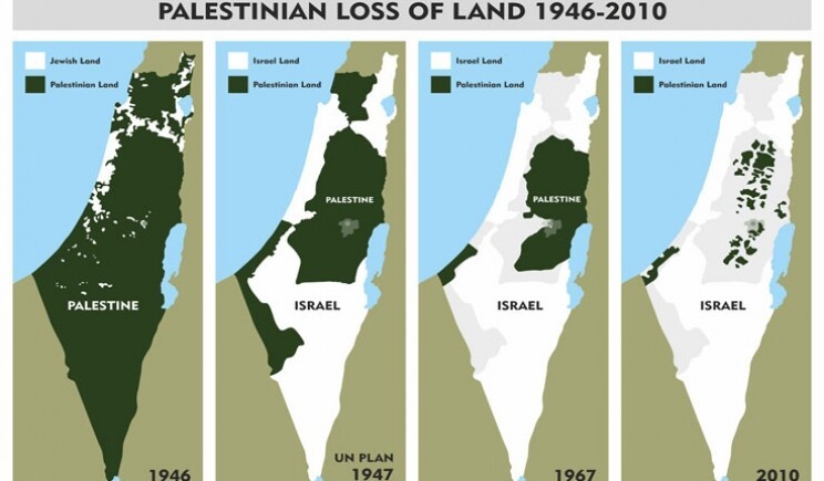
Four maps of the palestine/israeli region title "Palestinian loss of Land 1946-2010". 1946 map shows the region mostly in green ("Palestine") with some small white patches for Israel. Second map shows the "UN plan 1947, the area more or less split in two halves. Third map shows the situation in 1967, roughly 80% are Israel. Last map shows 2010, palestinian land only some spots, maybe 5% of the total area.
https://media.mas.to/masto-public/media_attachments/files/111/229/959/069/548/648/original/0b61651b0c1027b2.jpg